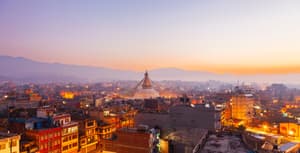
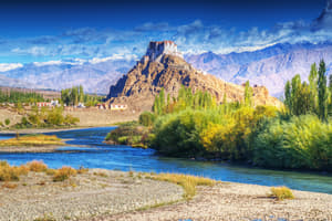
About Himalayas
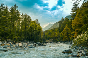
The great Himalayas are one of the best gifts of nature to mankind. This mountainous range is an earthly example of what heaven really looks and feels like. From thick woodlands to lavish valleys, from tropical wildernesses to compelling slopes, from various types of verdures to the sentimental climate, the Himalayan ranges have it all. If, by any chance, you get to visit the Himalayas just once you will be able to deduce why it's known as the heaven on earth. We step into Himalayan kingdom wonderstruck every time how boundlessly nature has gifted these terrains with beauty and resources. Mile after mile of never-ending virgin greens, the clean air full of oxygen, mineral-rich waters of mountain streams, wildflower carpet and strawberry shrubs—suddenly it is inexhaustible life all around!
Relatively few places on this planet can engage you like the Himalayas. Only one out of every odd place gives you the motivation to be there each season. Be that as it may, at that point only one out of every odd place is the Himalayas. Tourist places in Himalayas are the home to the extraordinary, compared to other enterprise sports zones on the planet.For thousands of years the Himalayas have held a profound significance for the peoples of South Asia, as their literature, mythologies, and religions reflect.
Since ancient times the vast glaciated heights have attracted the attention of the pilgrim mountaineers of India, who coined the Sanskrit name Himalaya—from hima (“snow”) and alaya (“abode”)—for that great mountain system. In contemporary times the Himalayas have offered the greatest attraction and the greatest challenge to mountaineers throughout the world. Likewise enjoy adventurous thrill in the Himalayas like trekking, boating, skiing, mountaineering and numerous others like this. For mountain lovers, the Himalayas are convincingly counted as the delegated peak of nature's greatness.
Tourist places in Himalayas also include notable lakes include Shey-Phoksundo Lake in the Shey Phoksundo National Park of Nepal, Gurudongmar Lake, in North Sikkim, Gokyo Lakes in Solukhumbu district of Nepal and Lake Tsongmo
 AWARDED BEST LEISURE TOURS BRAND


Official Partnerships
Himalayas Most Popular Tours


Himalayas FAQ's
Travel advice
When taking any of the Himalayan tours, you have to carry layers of warm clothes, socks, trekking gear, camping gear, sun screen, cold cream, moisturizers, safety and health emergency kit, gloves, hand warmers, many torches, wet tissues, swiss army knife, camera, GPS, snacks, water bottles, and anything else you can think of.
Choose a Himalayan trip and plan the itinerary. Whether you choose a pilgrimage trip, or an adventure and sightseeing trip, to any of the places that cover the Himalayan range, plan things you need prior to the travel.
Know the laws and regulations of countries like Nepal, Bhutan, and Tibet if you are visiting any of them as a part of these tours. They have strict laws with regard to entering religious places.
You have connecting and direct flights to most of the places in the Himalayan trips. If you want to visit places like Kailash and Manasarover, or Hilly locations in Uttarakhand and Himachal Pradesh, Sikkim, Ladakh, Kashmir, or any of the hilly stations and trekking sites, you need to go by walking trails after you reach a nearby station. You can also hire a taxi if it is available.
A few sites for adventurous and trekking activities are done in forests, snow laden areas and places near streams, rivers, waterfalls; and might not even have a constructed road. You have to choose your own transportation or hire one to reach these sites.
Himalayan tours always need preparation for clothes and other safety items you carry. Most of these places are safe to travel, as long as you are not travelling as a lone backpacker.
Drinking and non veg is not preferred in most of the places covering the Himalayan region. You must always ensure, you stay sober and eat fresh vegetarian food that is more hygienic than meat available in these areas.
Drinking Laws
There are strict laws for drinking in Nepal, Bhutan, Tibet, and a few places in the Himalayan range in India. You must never carry liquor while travelling to these places from any other location.
Our Recommendations: What you can’t afford to miss?
Temples, pilgrimage, and yoga retreats
Wildlife tours in the Himalayas
Cross Country tours
Recommended reads for destination
When is the best time to visit Himalayas?
The Himalayas being a mountainous range, experiences harsh winters. Hence, it is advisable to be aware about the weather changes throughout the year and best time to visit this heavenly region.
- March to June is a good time to visit the Himalayas as the temperatures rise after the intense winters from December to February.
- You can also visit during the months of September to November as the climate changes here in accordance to the elevation.
How to reach Himalayas?
The Himalayas are a vast mountain range and has many entry points such as Delhi in India, Kathmandu in Nepal, Paro in Bhutan, Lhasa in Tibet and Islamabad in Pakistan. People usually consider Delhi in India as a convenient and safe entry point to the Himalayas. It also depends on which place in the Himalayas do you desire to visit.
- You can take a flight to Delhi or travel by railways from any destination as Delhi being the capital of India, is well connected to all regions.
- By Car from Delhi - There are various routes available from Delhi via Hapur, Moradabad, Rampur, Moradabad, Haldwani, Bhimtal, Bazpur, Nainital etc. Drive upto 350 kms from Delhi which is a 6-7 hour journey.
- By Train from Delhi - This is one of best options for travelling to the Himalayas. You can travel by train from New Delhi or Old Delhi station and arrive at Kathgodam. From Kathgodam you can reach by car in 1.5 hours.
Which are the most famous attractions to visit in the Himalayas?
The Himalayas has so much to offer in terms of tourism. There are a variety of tourist destinations here and each place has a unique beauty of its own.
- Gulmarg - An enormous glade, rich and green with inclines where the quietness is broken just by the tinkle of cowbells, Gulmarg resembles a dream set in a film and it is a place where many movie scenes are shot.
- Srinagar - The capital of Jammu and Kashmir and the biggest city in the state, Srinagar (1,730m) is well known for its waterways, Houseboats and Mughal Gardens.
- Auli - Auli is settled in the lap of the snow-capped pinnacles of Garhwal in Himalayas in the Chamoli District of western Uttar Pradesh, close to the world well known religious sanctum of Badrinath.
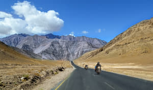
- Ladakh - Ladakh is one of the most famous tourist destinations in the Himalayas. With breathtaking views and picturesque landscapes, Ladakh is regarded as heaven on earth.
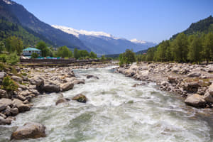
- Manali - It is a thriving plantation industry, a famous special honeymooners destination and trailhead for various treks.
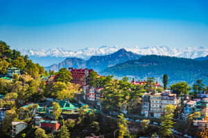
- Shimla - Shimla has been honored with all the characteristic bounties, one can consider. Harping on an all encompassing area, this beautiful town is encompassed by green fields and snow-capped pinnacles.
- Kullu - Kullu was once known as Kulanthpitha.In the past rose the restricting statures of the Greater Himalayas, and by the banks of the sparkling waterway Beas, lay the mythical 'Silver Valley'.
- Dharamshala - A snowy region with various streams and cool sound environment makes the surroundings extremely appealing. A bustling bazaar town, Dharamshala has set up itself as the voyagers base camp, who come to tour the close-by mountains.
- Darjeeling - Darjeeling a lovely town, has been a well known hill station since the British time frame. The vacationer’s dream to explore Darjeeling city has been expanding step by step.
- Kailash Mansarovar - For a thousand years, travellers have ventured Kailash Mansarovar to pay reverence to the mountain’s.
What are the different things to do in the Himalayas?
The different things to do in Himalayas are:
- Whitewater rafting - There are loads of crevasses rising up out of the highest point of the mountains in Himalaya, which implies water boating is precisely what you require feel that you're living.
- Trekking - Trekking is likely the most widely recognized sort of action to experiment with while in Himalaya. There are different courses accessible for both experienced and starting mountain dwellers.
- Yak safaris - This kind of movement is select to Himalayas Ladakh locale. Yaks are enormous creatures local to Ladakh, and numerous voyagers are quite recently intrigued by them.
- Skiing - No outing to the Himalayas can be finished without testing the inclines of Kumaon and Garhwal in winter. This regular skiing spot has turned out to be very celebrated in India
- Gondola rides - Gulmarg Gondola is the world's second most elevated and longest link auto in Asia. The rides start from 9,000 feet and they climb to 10,000 feet, in this way offering explorers the most mind blowing scenes
Which are the best resorts to stay in the Himalayas?
Luxurious resorts with enchanting views and over-the-top services are all that you can want for during your holiday in the Himalayas.
- Khyber Himalayan Resort and Spa - Spoil yourself in this extremely lavish Resort and Spa in Jammu & Kashmir. They also offer many outdoor activities like skiing, hiking, horse riding etc.
-
- The Himalayan Resort - A romantic and luxurious resort in Manali Himachal Pradesh will leave you with wonderful memories of this trip.
- Shakti 360 degrees - This resort offers panoramic views of the beautiful mountainous ranges. It is located in the Kumaon Valley region of Uttrakhand.
- Wildflower Hall - A honeymoon resort which will double the romance is famous for its exquisite interiors and over-the-top facilities. It is located in Shimla.
-
- Mayfair Spa Resort and Casino - One of best hotels in Sikkim is the Mayfair, surrounded by snow-capped mountains and lush green forests.
What are the best public transport modes to commute around Himalayas?
Himalayas are accessible from the North and the South. Due to the wide increase in tourism, good roads and railways have been constructed in the Himalayas.
- The best way to reach any destination in this region is by roads which have been constructed for the convenience of tourists.
- You can also reach quite a few major tourist destinations in the Himalayas by railways.
- Buses and private cabs are available for you and are the most convenient ways to travel by road.
Which are the best places for shopping in Himalayas?
Himalayas has a lot to offer in terms of shopping. When you explore the bazaars in this region, you may just get tired as there is so much to shop and it can be endless.
- Chowk Bazaar, Darjeeling - All shopaholic women will love this place as it offers a lot of exquisite clothing, handicrafts, special darjeeling tea and woollens.
- Mcleodganj Streets, Dharamshala - This place is famous for it Kashmiri shawls, woollen clothing, ethnic jewellery and a lot of stuff for Yoga and Meditation.
- Manali - Manali a famous hill station is popular for its exclusive Pashmina shawls. The are beautifully pieces of woven and designed cloth.
What are the most adventurous treks in the Himalayas?
The great mountainous region offers obviously, the best trekking adventures and is one the most famous regions for an adventurous trip in the world.
- Singalila Trek - You can expect magnificent view here. The trekking trail navigates through the Singalila National Park, which is an energizing aspect of the trek.
- Zanskar Trek - Strolling on the ice-secured waterway of Zanskar is an extreme affair for adventurous people in the Indian Himalayas.
- Markha Valley Trek - A standout amongst the most renowned in Ladakh, this trek navigates mountains to remote towns and devout settlements in the colossally lit lunar landscape of the Markha Valley.
- Hampta Pass Trek - It is the best trek in Himachal Pradesh to seek after with family. Simple access, open glades, valleys and lavish green pine woods, you can appreciate with your children the magnificence of unblemished nature and pristine environment.
What are the adventure activities one can enjoy in the Himalayas?
This enchanting destination has a lot of adventure activities to offer for all adventure enthusiasts. Your trip would be a memorable one even if you try any one of these.
- Paragliding in Ladakh - Feel thrilled by a surge of excitement and unadulterated bliss paragliding over Ladakh. Situated in the Indian province of Jammu and Kashmir, is an amazing getaway for adventurous activities.
- White Water Rafting in Rishikesh - Whitewater rafting in India resembles a wrestling match with mother nature which can be delighted in by all who set out to acknowledge the test of the turbulent rapids of River Ganga.
- Chadar Trek - Chadar Trek in Ladakh falls into the tough category of trekking activities. The most extreme peak of the trek is around 11,123 ft and it covers approximately 40 miles.
- Heli-Skiing in Auli - Heli-Skiing is an experience movement which has increased significant fame in the Himalayas as the years have progressed.
- Hiking in Har ki Doon Valley - The broad inclines of Garhwal and Kumaon locale are covered with thick layer of crisp snow in winter and turn into a regular problem area for skiing in India.
What are the famous hill stations in Himalayas?
With snow-capped peaks and spectacular views, these famous hill stations must be on your travel list while visiting the Himalayas.
- Gulmarg - A colossal meadow, rich and green with slants where the calm is broken just by the tinkling of cowbells, Gulmarg takes after a fantasy set in a film as many films have been shot here.
- Ladakh - Ladakh is a standout amongst the most renowned visitor goals in the Himalayas. With stunning perspectives and beautiful scenes, Ladakh is viewed as paradise on earth.
- Manali - It is a flourishing estate industry, a popular exceptional honeymooners goal and trailhead for different treks and adventure activities.
- Shimla - Shimla The uneven town is enveloped by green fields and snow-topped zeniths.
- Darjeeling - Darjeeling has been a popular hill station since the British time span. The vacationer dream to Darjeeling city has been ever expanding.
Where can one enjoy skiing in the Himalayas?
Spots, for the most part over 7,000 feet height, get great measures of snow in the winter season and wind up as plainly fantastic spots to appreciate skiing. These spots have turned out to be so mainstream that numerous resorts have come up there, with many providing this brilliant sport.
- Solang: Solang, the winter sports capital of Himachal Pradesh, has an rise of 8400 feet above ocean level. Cable cars available here will transport you at a stature of more than 1500 feet from its base station.
- Auli: At a height of roughly 10,000 feet, Auli is truly outstanding and the most noteworthy skiing goals in India. With a cable car from the town of Joshimath, you can go to this captivating snow capped region.
What are the famous destinations for river rafting in the Himalayas?
The streams in the upper Himalayas are among the best on the planet for waterway boating sports.The most mainstream boating locales are Ladakh in Jammu and Kashmir, the Garhwal Himalayas in Uttaranchal, the Beas River of Himachal Pradesh and Teesta River in Sikkim.
- Ladakh river rafting - This thrilling experience starts from the Indus river in Ladakh.
- Zanskar river rafting - It is one of the most difficult yet exciting whitewater rafting experiences.
- Gange's river rafting - Enjoy rafting in the sacred river Ganges, which is one of the best adventure activity.
- Garhwal river rafting - You can also go for rafting in Garhwal Uttaranchal where this sport takes place along the mighty Ganges river.
Which are the best biking routes in the Himalayas?
Himalayan biking tours are one of the super adventurous and challenging experiences for riders. You can opt for various biking tours here.
- Riding tours from Delhi to Leh - An amazing tour to Leh while stopping on various other famous hill stations.
- Riding tours from Delhi to Manali - You must try this tour as Manali seems different when you explore it on a bike.
- Riding tours from Leh to Pangong Lake - One of the most exciting biking tours in the leh-ladakh is this one as the picturesque Pangong Lake is a must visit.
What are the things to keep in mind while travelling to Himalayas?
As the weather here is cold here and harsh sometimes, it is a necessity to plan your trip with all required commodities required during travel.
- Warm clothing - Make sure you carry sufficient warm clothes here as the weather is pretty cold and unpredictable, especially when you go on a trek.
- Camera - You must keep in mind to carry a good camera to capture the beautiful scenic views of the Himalayas, as you will encounter many of them.
- Trekking shoes - Special shoes are available for trekking and as you will be visiting many snowy regions here, it’s better to carry a pair.
- Travelling gear - You will need a rucksack and other accessories on your trip, so don’t forget these and pack accordingly.
What to Pack for Annapurna Circuit Trek ?
On one hand, you cannot underestimate the chilly weather in the mountains and on the other hand, you must be aware of the fact that you have to carry whatever you pack on your shoulders for quite some days. Hence, it is important to make a reliable checklist on the basis of the essential things you need to pack for your trek.
- Backpack
Proper Clothing - To save your body from the freezing temperatures
Proper clothing is very important for staying warm and comfortable during the Annapurna Circuit trek. So, make sure you carry clothes that keep moisture and cold away and help you move up comfortably in the trek.
First Aid Kit - To make sure you are attended in case of any emergency
A small, handy first aid kit that can help you take care of yourself during minor health emergencies. Since it can be difficult to get medicine on the Annapurna circuit, make sure your pack all the common and basic medications you think can be of any potential help to you in the trek.
Footwear - To go conquer every terrain
While you need a pair of robust and waterproof hiking shoes to balance yourself on plains, grainy riverbanks, muddy grounds, and thick snow, you also need a pair of flip flops to use the loo, go take a shower, and stroll around the region. So, make enough space to pack these basic footwear:
Toiletries - To maintain your personal hygiene in the mountains
Toiletries are something that we normally need everyday, irrespective of where we are and what we are doing. The toilet essentials not only help you to be comfortable on the treks, but they also let you maintain your personal hygiene. So, make sure you pack these toiletries that you will be requiring every day during your activity:
Food and Snacks - To have your own box of eatables in the mountains
Electronics - For your convenience with the gadgets even at high altitudes
Everyone needs the basic electronic gadgets that can make their outing convenient, smooth, and fun. While a cell phone can help you stay connected to the world during your trek, cameras can let you capture some stunning pictures of the vistas on the trail. So, do not forget to carry your electronic goods when packing your bags for the mountains.
Accessories - To trek without compromising
Keep the final section of your bag for some offbeat and random accessories that can be worth carrying for the trek. Here are some miscellaneous items that you may think of packing, right before zipping your bags for your trekking trip:
How long is Everest Base Camp Trek ?
However, the pace decreases at some parts of the trek owing to higher altitude gains and rocky terrains. The length of the Everest Base Camp trek is quite achievable for almost everyone with a good level of physical fitness. The ascending route from the town of Lukla to the Everest Base Camp happens to be longer than the descending route, in terms of time. This is for the reason that the longer route allows good acclimation and reduces the chances of high altitude sickness.
The Everest Base Camp trek has a challenging elevation. The elevation of the EBC trek at Lukla town, the starting point of the trek, is around 2,600 meters. Since the bodies of many trekkers are not accustomed to such high altitudes, they are offered a good number of acclimation days.
That said, the hike to the Everest Base Camp takes place at a slower pace in comparison to the descent for ensuring safety and avoiding any potential medical conditions like AMS. The usual altitude gains per day ranges from 400 to 800 meters. The days with high altitude gains are generally followed by acclimatization days during which the trekkers spend time exploring the nearby areas and sightseeing.
2. Namche Bazaar
3. Khumbu International Library
4. Old Monasteries and Gompa
5. Kala Patthar
What is the Difference Between - Annapurna Circuit Trek vs Everest Base Camp?
Annapurna Circuit Trek
Everest Base Camp
- Terrain Conditions
Annapurna Circuit Trek
Everest Base Camp
- Accommodations
Everest Base Camp
- Food And the Water supply
Annapurna Circuit Trek
Everest Base Camp
- Difficulty Level
Annapurna Circuit Trek
Everest Base Camp
The trekkers will hike up to 3420 meters in two days on the Everest Base Camp trek whereas they will trek this height in six days on the Annapurna Circuit Trek.
- Best Time for Trekking
Annapurna Circuit Trek
Everest Base Camp
What is Kheerganga Trek Distance?
There is no direct train or air connectivity to Kheerganga trek but you can book a bus or private taxi to Kasol from Delhi or Chandigarh. From here, you can take a local bus to Barshani that is the base for the KheerGanga trek and the last motorable spot of Parvati Valley.
Yes, the KheerGanga trek is safe for all kinds of travelers, solo, group, and even couples. The trek has a number of cafes and stays en-route that will make your experience even more comfortable.
What is Kareri Lake Trek Height?
The lake is a popular trekking destination and attracts many adventure enthusiasts who set their base camp here before proceeding towards Chamba and Bharmour through the Minkiani Pass and Baleni Pass.
Kareri Lake is also known for having an ancient temple set in a backdrop of scintillating views and dedicated to Lord Shiva and Shakti. Moreover, the lake is a respite for nature lovers as one can see that it serves as a fantastic grazing ground for the animals bred by the Gaddi tribe which resides near Kareri Lake.
It is a scintillating 3 day trek that covers a ground of 25-30 kms amidst the bounties of nature. The trek starts from Mcleodganj from where one has to take an uphill climb towards Kareri village that is located at an altitude of 1,800 metres.
The trail then ascends furthur to Kareri Lake via a journey that is full of beautiful oak and pine trees and gorgeous winding ridges. The thrilling trek is one of the most sought after adventure activities as you get a chance to explore the fascinating beauty of the landscape tucked in the lap of Himalayas.
How to reach Kareri Lake?
The nearest airport to Kareri Lake is the Gaggal Airport or Kangra Airport at Dharamshala which is about 20 km away from McLeod Ganj. One can book a cab from there to reach Mcleodganj to proceed for the trek.
- By Train:
Located at a distance of 90 kms, Pathankot Railway Station is the nearest railway station. One can easily get a cab from the railway station to reach Mcleodganj or Kareri village.
- By Road:
The nearest city to reach Kareri Lake via road is Mcleodganj that is j is well connected with all the major cities of North India. One can book a cab for Kareri village from Mcleodganj which is about 35 km away.
- Keep your stack of ready to eat food after you proceed from Kareri village for the trek since it is the last stop where food is available.
- Plan at least one or two months before going on the trek. Try to maintain a reasonable level of fitness by incorporating activities like yoga, swimming, cardio etc. in your daily routine along with a healthy diet.
- Take your time to acclimatize yourself during the hike to fight Acute Mountain sickness which happens due to lack of oxygen.
- Carry a raincoat and windcheater to protect yourself from any unexpected downpours during the trek.
- Take along the required camping gear like trekking poles and trekking shoes to maneuver through the steep climbs.
- Keep a minimum load of baggage so as to avoid any extra strain on your body while trekking towards the top of Kareri Lake.
What is Chopta to Tungnath Trek Distance?
This steep trek to the peak leads you to the highest shiva temple in the world. With a high altitude of about 13000 ft above sea level, trekkers take about 5-6 hrs to complete the trek depending on their physical ability.
The cold weather, the high altitude and minimum facilities makes the trek a challenging trail to take yet its enticing view is worth the struggle. The mesmerizing view of the shades of blue in the sky, the snow capped mountains, the thick fog and the dense coniferous forests with the sun shining on top will tempt you to stop and take a breath.
The temple top has the Shiva temple along with multiple other small temples that remain closed during the winter. However, you can still make it to the top of Tungnath, ring the temple bells and experience the feeling of the presence of the higher power.
Moving forward after a stop at Tungnath, trekkers head to Chandrashila. This is a kilometer ahead of Tungnath and can be conquered sooner. This is the peak point of Garhwal Himalayas. The 13,000 ft high view of Chandrashila is a milestone achieved for many trek enthusiasts. The complete trek takes about 5 days.
- Keep yourself physically fit and have a fitness routine to be able to trek
- Start your trek as early as possible in the morning to be able to comfortably make it to the top.
- Stay hydrated. The hike, the high altitude and the low oxygen level will make you thirsty, carry your own water supply during the trek.
- Carry your own trek essentials as it isn’t provided at the spot.
- The only way to reach on the top is by a steepy hike, so do not bring along elderly parents or young kids who wouldn’t be able to make the hike.
- The higher altitude and the required physical strength to make the hike is very important to be kept in mind. Do not make the trek in ill health. There is no medical facility available on the top or through the way.
Can we go for Chopta Tungnath Trek in November?
The temperature goes as low as 5C and can be expected to drop to -5C. The extreme cold makes the trek difficult. November is also a transition period and so, the view turns dull. Green but dull. However, regardless of the month the view on top of the mountain range never disappoints anyone.
You can camp by the bonfire, stargaze and stay up watching the changing colours of the sky. It is suggested you start your trek early in the morning, so you don’t have trouble reaching the top. You should also know that November will be one of the safest months to take the hike, as there is no slippery monsoon or landslide to be worried about. It is cold but calm and you can make your way comfortably to the north.
- Pack warm clothing as the cold will get to you.
- Carry handy medication that you might need in any case.
- Prepare to walk long miles with comfortable footwear.
- Take a walking stick along which will make you climb easier.
- A camera or a mini telescope might make your trip interesting while you stargaze or capture the view amidst your trek.
- Camping tents and sleeping bags add to a fun experience.
- Make sure you are physically fit and medically fine to make this trek and can bear with the cold weather.
- Carry ample water as you will be easily dehydrated at the high altitude region.
- Carry woolens and trek essentials to climb the steep covered with snow.
- During the winters, there is no food facility from trek entry gate to the top of Chandrashila so do carry your own supplies.
To arrive at Chopta trek point you can opt to travel via air, rail or by road in the month of November:
By Air:
Dehradun’s Jolly Grant Airport is the nearest airport to Chopta. It takes about 6.5 hrs to cover the distance of about 211 km to Sari Village near Chopta by road in a private vehicle.
By Rail:
Haridwar is the nearest railhead from which trekkers head to the base camp of the Chandrashila trek.
By Road:
Private buses, government buses, and taxis all the way from Haridwar to Chopta which cover about 200 km in little less than 8 hours are available for the trek enthusiasts.
How to reach Brahmatal from Delhi?
By Air
By Train
In both cases, you take a taxi to Lohajung from Kathgodam to reach base camp. The taxi journey takes 7 hours, 45 minutes. This is the fastest way to reach Lohajung.
By Bus
By Car
Nearest Railway Station
You can then meet your trek guide or coordinator in Lohajung, as that is the base camp for the Brahmatal trek.
Refrain from going in monsoon as the trail gets muddy and slippery. The best time for this trek is in winter. The trail is dry, and the lake freezes. However, taking into account the weather, you have to carry a windcheater and heavy woolens.
What should be the fitness level for Everest Base Camp?
If you are interested in participating in this very accessible trek of 130km at about 3000m altitude, then you should take 8-12 weeks to prepare yourself for a mountain trek. Since you would be trekking for a good 9 to 14 days at Mount Everest, it is a good idea to start practising by going on walks and even hikes for a stretch of 5 hours.
The focus here shouldn’t be on the distance covered; instead, it should be the duration, take minimal breaks and start by hiking/walking for 3 - 4 times a week. If you do not have hilly terrain to climb onto, practice on gym equipment for a few hours and a minimum of 5 times a week.
Now, you may be regular with workouts and are quite fit, however, you may still need to do some additional prepping for a mountain trek. The amount of work you would have to put in depends on your current physical condition.
If you are someone who workouts/trains 3 - 4 times a week doing cardio and weights, you will require less time and preparation. If you are someone who isn’t quite regular with exercising, you may want to give yourself a minimum of 12-15 weeks to train for a hike like the EBC.
Moreover, include breathing exercises and meditation as part of your preparations, and you must also get your health examined by a doctor before starting any rigorous training.
Moreover, enough practice and preparation will make the entire trek much more enjoyable. There are 2 options to train yourself for the EBC trek:
1. Practice Hikes:
A practice hike is the closest you can get to the actual hiking experience and is the best way to prepare for Everest base camp. Start by following:
- Hike or go on long walks
- Start by 1 to 2 hours and gradually build it up to 5 to 6 hours with minimal rest intervals
- Initially go twice a week and increase the number of days from there
- Choose a hilly, uneven gravely terrain for these hikes, if possible
- Start without any additional weight, then start wearing your daypack and over time, slowly increase the weight of its contents till it gets to 25lbs
2. Gym Workout:
Working out in your gym you wouldn’t be able to replicate the natural activity however, it would help you improve your overall fitness, which in turn will be beneficial during the EBC hike.
- Spend at least 45 minutes on the treadmill on hill setting (for a walk or a slow jog)
- Practice by climbing staircases or spend 10 minutes on the stair-stepping machine, either of these should be done at a speed of 30-45 steps per minute. You can gradually increase the time limit
- Run on a slope or slow slow walk with no incline for 10 minutes to improve your breathing. Again increase the intensity with time
- Repeat these exercises 2-3 times by performing a few reps
- For strength training, add 3 sets each of 30 lunges and squats, it’ll help build those leg muscles. Also, do plenty of stretching exercises and you can also practice with your backpacks on for better results
Meanwhile, you must incorporate an hour of respiratory exercises to improve your aerobic conditioning.
Additional information
- You also want to look at your food and nutrition intake by eating healthy and providing your body with all essential nutrients, protein and carbohydrates.
- Take enough time to prepare yourself for the hike. If you believe that you would require more than 12 -15 weeks, then be it. You could be flexible with the training but regular so to be able to build stamina.
- You should also learn a few stretches that will help you before, during and even after the trek. That being said, you must also give your body enough rest right before you commence on the trek. Therefore, take a day’s rest when you get to Nepal, before starting the trip.
What is the Altitude of Mount Everest Base Camp?
One base camp is in Nepal, and the other is in Tibet, China. The base camp at Nepal is known as the South Base Camp and is at the altitude of 5,364 metres (17,598 ft). The other one at Tibet, China is known as the North base camp and is at the height of 5,150 metres (16,900 ft).
The final destination where one can stay for a while is the Rongbuk monastery. At this place, trekkers usually stay to admire the starry nights and the milky way which can be seen rightly from the Rongbuk monastery's unpolluted environment. From here, the Everest base camp is just 5 km away, making it the final place to take some rest.
Is Kareri Lake Trek Difficult?
The trail starts with a steep gradient and then levels out over the ground. The trail becomes easier as it has a lot of steep parts where you can climb by using the steps which have been cut through the rocks by the locals. It passes through several serene landscapes which comprise of rhododendrons and pine forests.
In the end, the trekkers are rewarded with a surreal view of Kareri Lake. Kareri Lake trek reaches up to an elevation of 9600 feet above sea level where Kareri Lake is located in the Himalayas. Kareri Lake is a suitable trek for beginners with moderate fitness, children above 10 years and experienced trekkers.
One should start at least 4 weeks before the date of the trek by incorporating a fitness schedule in their lifestyle. The routine should involve a mix of exercises with cardio workout and strength training. The cardio workouts like walking, jogging, cycling etc. are necessary to strengthen your heart and lung muscles along with improving the utilisation of oxygen in the body.
Strength training is necessary to tone your muscles and helps you prepare physically for the trek. Moreover, beginners can prepare by maintaining a regime of proper diet and rest in order to prepare themselves for any situation that can occur during the actual trek.
You have to start trekking from Dharamkot towards Kareri Lake. The distance covered on the first day is 8 kms and then one can rest for the night in one of the village houses of the Gaddi tribe.
- Day 2:
The distance covered on this day is around 13 kms as you make your way towards Kareri Lake. This day, one can enjoy the vistas of the lake along with Minkiani pass and stretches of oak, pine and rhododendron forests.
- Day 3:
This part of the trek is a downhill journey which can be completed by trekking for about 7 kms to reach towards the base of Kareri village and then leave for Dharamkot.
The best time to enjoy Kareri Lake trek is from May to June and then from September to October. The season wise description for best time to take Kareri Lake trek is as follows:
- Spring Season:
During the months of March and April, the valley is full of colorful blooming flowers in the forests. It is a good time to escape the crowds, however, the temple may not be open.
- Summer Season:
This is the peak season for trekking and offers a pleasant time to have a great adventure. The overall weather is good and it allows a nice trail for the beginner trekkers.
- Monsoon season:
During this time in the months of June, July and August, the rains may hamper the trekking expedition. However, it is a good time to enjoy the religious extravaganza of Kareri Lake as locals come to the temple to celebrate Krishna Janmashtami. .
- Winter Season:
From the month of November to January, the winter season is a delight for experienced trekkers who want to traverse through the snow. It becomes a challenging encounter for anyone looking to have a wonderful Himalayan trek.
What are some things to know before going on Kareri Lake trek?
- One should always be carrying the rain gear despite the weather forecasts as the Dhauladhar valley is known for many instances of unexpected rainfall.
- One should invest in proper shoes as some parts of the trail are rocky and will require stiffer outsoles for a comfortable trek towards Kareri Lake.
- Do not indulge in drinking while trekking during the day.
What will be the Kuari Pass Trek Route?
The entire trek is for six days which would enable you to be a part of an adventurous trip with enchanting scenery and destinations of the Himalayas. The trek to the Kuari Pass will start in Haridwar, where the travellers would be taken to Joshimath over a 256 km drive which would take approximately 10 hours.
Here, you can spend the day resting or visiting the significant pilgrim spots Devprayag, Bhagirathi and Alaknanda confluence amidst the beautiful landscape. The actual trek will begin at Dhak village which is about 12 kms from Joshimath and trekkers would be driven there.
At Dhak village the trek will start through the village displaying the day to day lives of Garhwali people, along with the views of the mountain peaks during the trip. The trek is till Gulling Top and would be completed in parts by stopping at Tugasi village and Gulling village to take some rest and to adjust to the high-altitude atmosphere.
By entering Gulling village, the trek to the Gulling top campsite would be a mere 500 m. The day would be concluded with a night of camping under the starry sky around the vibrant flora or a milk-white layer of snow, depending on what time of the year you trek.
The next day, at the height of 2,900m/9,600ft through mixed terrain of soft and steep ascent, the trekkers would head to the Camp which is a 5.5 km trek from Gulling Top and would take around 5 hours to get through. The entire route is engulfed in oak, rhododendron (mostly pink and white) and walnut forests with different coloured leaves in different seasons, regardless of which the trail is amusing.
After getting to the Camp, it would be rest-day to prepare oneself for the final leg of the trek to Kuari Pass. On day four, the trek will commence from Camp, near Gulling top to Khullara and finally to Kuari Pass at 12,500 ft above sea level. The complete trek from Camp to Khullara to Kuari Pass would be around 8-9 kms and would take 5-6 hours to complete.
Surrounded by meadows of wildflowers and yellow-green grass along the way with the grey-blue gigantic Himalayan peaks still in sight, the trek will not feel tedious or exhaustive. As the halfway mark, you would reach Khullara that has a broken bridge and a frozen stream that you will be traversing to get to the final destination of Kuari Pass.
Spend the rest of the day and night absorbing the natural beauty and the majestic sight of Kedarnath Peak, Kedardome, Chaukhambha, Balakun, Neel Kantha, Mukut Parvat, Kamet, Abhi Gamin, Mana I, Ghori Parvat, Hathi Parvat, Dronagiri, Kalanka, Chang Bang, Nanda Devi, Nanda Ghunti.
Besides that, set up a camp for the night, before descending back to Dhak village and driving back to Joshimath to rest for the night and finally heading back to Haridwar to conclude the entire trek of Kuari Pass.
What is Kuari Pass Height?
The trek to the Kuari Pass is that of a moderate to easy difficulty as the terrain isn’t too steep or exhausting, making it ideal for even first-time trekkers and kids above the age of 8.
The final half of the first lag is from Gulling village to Gulling top at about 9600 ft, and it is a short trek of about 500-600 metres. After getting to and resting at Gulling top, there will be a trek of about 5.5 kms to the Camp, at about 11,000 ft km. The route is covered with splendid Oak, Rhododendron ( pink and white) and Walnut forests but also gets steep in parts of the ascend.
After camping the night at the Pass, you will be trekking back to Dhak village from here you will be driving to Joshimath to complete the whole trudge. The journey from Joshimath to Kuari Pass will take around 5-6days by the end of which you would have travelled 31 kms. Also, you would have covered an elevation of 5,750 ft by the end of the trek to the Pass.
How difficult is Goechala Trek?
With an approximate length of around 90 kilometers, Goechala trek starts from Yukosm and ends at GoechaLa. The duration of the trek is 10 days and the travelers will complete the activity on the eleventh day. The trekkers are expected to cover a distance of around 9 kilometers each day during their activity.
Since Goechala trek manifests a lofty altitude and offers a considerably harder climb, you need to prepare yourself in advance to conquer the heights and acquire the best experience. Here are some of the steps that can help you in your preparation for Goechala trek:
1. Know the trail properly
As the trekkers hike through their trail, they can get an opportunity to encounter some of the world’s loftiest mountains including Mt. Kanchendzonga, Mt. Simovo, Mt. Kabru, and Mt. Pandim.
2. Get yourself ready
It is suggested to try jogging 5 kilometers within 30 minutes. In addition to cardio workouts, you must also practice stretching exercises regularly. This will help your body in building the hip, calf, and shoulder muscles and allow you to prevent immense straining of your hip and lower back during the trekking activity.
3. Pack the essentials
1. Summer
That said, however, there is still enough snow in the trek, which allows the travelers to trek comfortably without missing out on the snow. During this time, the lower altitude gets filled with colorful flora while the sky looks bustling with a myriad of unique birds including Grey Bushchat, European Sparrow, and Greentail Sunbird.
4. Winters
What is Har ki Dun Trek Difficulty Level?
The frequent rainfall in the region can also pose to be quite a thing to deal with. The moderately difficult trails of the Har ki Dun trek are best traversed by intermediate level trekkers. That said, the beginners can also hike this trek if they are determined, fond of adventures, and want an ambitious beginning.
The beginners need not worry about the long trekking period as they would not be covering the entire distance of 47 kilometers at a single stretch. They would only need to trek a maximum period of 5 hours and an utmost distance of 9 kilometers each day.
This can provide them enough time for acclimatization and rest in the course of the trek. Furthermore, if the beginners are physically fit, they would not face much difficulty in hiking the trek and the Har ki Dun trek can be one of the most ideal treks for them to start their trekking journey with.
1. Plan well for the trek
2. Enhance your fitness level
3. Pack all the essentials
Since there is not much rain at this time, the trails remain dry, minimizing the difficulty level of the trek. During autumn, the atmospheric conditions remain calm and the trek gets filled with colorful flowers. At this time, there is neither much rain nor the temperature is too low for a chilly weather condition and snowfall. So, the trail remains significantly easier, even for the beginners.
- Do keep yourself prepared for the frequent downpours on the trek.
- Do take care to maintain your wellness by taking enough water and rest.
- Don’t indulge in drinking alcohol on the trek.
- Don’t go too far from the campsite and your trekking group.
What is Har ki Dun Height?
The low to moderate Har ki Dun altitude offers the trekkers easy ascends and gradual descends. However, the low height of the trek does not let the trekkers get disappointed about the views of the panorama and offers enchanting sights of the spectacular Bandarpunch range lying in the southeastern horizon.
To start with the trek, the hikers will have to drive from Dehradun to Sankri, which makes for an approximate height of around 6,400 feet above sea level. The trekkers then have to trek from Sankri to Pauni Garaat through Taluka with the Taluka region being at a height of around 7,000 feet above sea level and Pauni Garaat nestled at a height of about 8,200 feet.
Although the height of the Har ki Dun trek is low to moderate, yet a handful of the beginners and novice trekkers may experience medical conditions, such as Acute Mountain Sickness (AMS), headache, and common cold. These conditions are quite normal and genuine and can be prevented by taking some basic measures.
These issues can be prevented by drinking enough water every day on the trek, taking sufficient rest, having patience, and avoiding smoking or drinking. It is also advised to the trekkers to visit their doctor and get the required medication for AMS before heading for the trek.
One can also consider wearing triple layer clothing to stay away from the chilling weather condition. It is also a better idea to pack some medicines for common cold and fever in the trekking backpack.
What is Har ki Dun Trek Distance?
Although the trek is significantly long, the trekkers will love their journey, which is packed with picturesque vistas and stunning elements.
The route of the Har ki Dun trek starts from Sankri and covers important spots like Taluka, Osla, Har ki Dun Pass, and Jaundhar Glacier to finally end at the spot from where it began.
There are a plethora of interesting and exciting things to look out for on the Har ki Dun trek.
1. Sankri Village
The amazing Sankri Village is a true delight for every trekker. This place offers the trekkers spellbinding panoramic sights of the majestic Himalayan skyline as well as a myriad of other mountain peaks.
2. Osla Village
On the route from Sankri to Har ki Dun, the trekkers will get to witness the beautiful and quaint hamlet of Osla Village. This village is nestled at an approximate elevation of about 2590 meters above sea level and dotted by stunning apple trees on all its sides. The small wooden houses in Osla Village can grab the attention of all the trekkers and force them to explore the place.
3. Marinda Tal
The world-famous Marinda Tal happens to be a serene lake, perched at an approximate height of around 3,970 meters above sea level. With the Swargarohini range forming an amazing backdrop, this lake makes for a truly picturesque sight.
One can also find a myriad of Brahma Kamal blooming along the periphery of the lake soon after the monsoons. Marinda Tal is a real paradise for the trekkers seeking peace, calmness, and natural beauty.
4. Jaundhar Glacier
Jaundhar Glacier is located at an approximate trekking distance of only 6 kilometers from the Har ki Dun pass. This trek is filled with amazing rocky formations and stunning views of the pinnacles of various mountains. The lofty Swargarohini Peak overlooks this beautiful glacier, adding more charm and elegance to this iconic destination.
Can I do Har ki Dun Trek Solo?
1. A backpack
2. Personal medical kit
Band aids, Bandages, Dettol, and medicines for AMS, dehydration, cold, and headache
3. Toiletries
Wet napkins, pads and tampons, toothbrush and toothpaste, hand sanitizer, shower gel, moisturizer, lip balm, sunscreen lotion
4. Clothing
Thermal inners, full-sleeves shirts, trekking pants, fleece jackets, woollen gloves
5. Footwear
Trekking boots, flip-flops, and sneakers
6. Accessories
Torch, sunglasses, and caps
7. Snacks
Energy bars, biscuits, and dry fruits
8. Trekking Equipment
Crampons, Ice Axe, headlight, polarizing sunglasses, sleeping bag, trekking pole, swiss knife, and waterproof map of the Har ki Dun trek.
9. Electronic Gadgets
Camera, cell phone, power bank, universal adapter
10. Sufficient cash
Before heading for the Har ki Dun trek, you require taking the permit and permission of the Indian Mountaineering Foundation (IMF). The permit usually gets issued within one day of your application. You also require carrying your id proof and medical certificate.
The medical certificate will act as proof to check if you are physically fit to go for the trek. If you are a non-Indian trekker, your passport and visa will also be required for the trek.
There are a plethora of exciting things that solo trekkers can enjoy on the Har ki Dun trek.
- Enjoying bonfire activities with the fellow trekkers
- Camping under the starry night sky
- Taking stunning pictures of the spellbinding mountain vistas
- Playing with the fresh snow (if you’re trekking during the winters)
- Catching a glimpse of the picturesque pinnacles of various mountains including Black Peak, Swargarohini - I, II, and III.
- Consider hiring a knowledgeable and experienced guide to accompany you on the Har ki Dun trek.
- The only place where you will find ATMs is Purola. So, withdraw enough money you want for the trek from here itself.
- You may experience weaker network connectivity from Purola to Sankri. So, make sure you are done with your telephone and internet requirements before leaving Purola.
- Consider hiring a porter, if you face difficulty in carrying your luggage alone through the trek.
How to Prepare for Annapurna Base Camp Trek?
Physical training required for Annapurna Base Camp Trek
The difficulty level of the Annapurna Base Camp is moderate and you don’t need any prior trekking experience. That said, however, since the ABC trek is perched at a high elevation and involves a seemingly rough terrain, you need to be physically fit to complete the trek.
So, you need to practice some regular physical exercises in advance of your travel dates. Here are some of the physical workouts you can do to increase your level of fitness for the trek:
- You should practice brief walking for an hour every day.
- You also need to do some cardio workouts like running and cycling, for a couple of weeks to enhance your strength.
- Practicing yoga asanas is also recommended to increase your focus and concentration power.
Gears and Equipment required for Annapurna Base Camp Trek
When you are getting yourself ready for the Annapurna Base Camp trek, it is important to make sure that you have packed the right gears and equipment needed for the hike. That said, here is a checklist of the things you need to carry for your ABC trekking:
1. A trekking pole
If you are going for Annapurna Base Camp trek during the winter season, you need a pair of good trekking poles to walk comfortably on the thick layer of snow. The poles will allow you to keep your pace and maintain your balance on uneven terrains and slippery rocks.
They will also reduce pressure on your knees and ensure stability on the slopes. During any normal day of trekking, the hiking poles can even help to whack branches and bushes coming in your way.
2. Waterproof trekking shoes
In the course of your trekking activity, you will be walking on rough and steep terrains daily. A pair of good shoes will help you maintain your stability on the trails and reduce straining of your feet. Waterproof shoes can be an added advantage as they can soak moisture and keep your feet dry.
3. A water bottle and a portable water purifier/ water purifying tablet
Dehydration can occur very quickly when you are trekking for days together. Hence, it is important to carry a good quality water bottle, which you can refill and use throughout the trek. Furthermore, make sure you carry a portable water filter or some water purifying tablets so that you can get clean water for yourself at the higher altitudes.
4. A sleeping bag
In the upper regions, the nights can be very chilly. A good, liner sleeping bag can help you keep the cold away and sleep peacefully.
5. A headlight
A headlight or a handy torch is important for you to figure out your ways in the evenings or when the sky is cloudy and dark.
6. Toiletries
Toiletries are no doubt one of the very basic things to pack as you won’t find and resorts or hotels offering you these essentials in the mountains. Hence, make sure you carry your toilet paper, toothpaste, toothbrush, body lotion, and hand sanitizer.
7. Personal medicine and first aid kit
If you are on medication, make sure you carry your medicine kit. In addition, do not forget to keep a small first aid kit with Oral Rehydration Salts (ORS), an antiseptic cream, and Dettol.
8. A pair of gloves, liner socks, thermals, a woolen hat, and an insulating jacket
It goes without saying that the trails at the higher altitudes will be extremely cold. Some good woolen garments, thermals, scarfs, liner jackets, and socks and help you in coping with the chilly temperatures in the trek.
9. Electrical Gadgets
Electrical equipment like your cell phone, camera, and power bank are an uncompromisable necessity. So, do not forget to pack your electrical gadgets before leaving for the trek. You can also carry an universal adapter to charge your phone, camera, and power bank in the tea houses.
10. Cash
Remember to carry enough cash with you for the trek as you would not find any ATM on the trails, in the course of your hike. The only ATM facility available is in Pokhara, which happens to be the beginning and ending point of your trek.
Documents required for Annapurna Base Camp Trek
1. Visa
Foreign travelers can get their visa from Tribhuvan International Airport (TIA), Kathmandu, Nepal upon their arrival. One may need to face a long queue during the peak hiking seasons. Travelers can even get their visa easily from the Nepal embassy in their country before their travel dates. That said, however, Indian travelers do not need to carry a visa to enter the country.
2. Trekking permits
Travelers, who are interested in going for the Annapurna Base Camp trek need two kinds of trekking permits - TIMS and ACAP. Transport Information Management System (TIMS) is important for all the trekkers going for trekking in Nepal. Annapurna Conservation Area Entry Permit (ACAP) is required for all the trekkers interested in trekking the Annapurna region.
3. Travel insurance
Trekkers are strongly recommended to get themselves travel insurance covering their trekking activity as well as all the critical things related to it such as emergency evacuation programs.
4. A map of the Annapurna Base Camp trek
A map of the Annapurna Base Camp trek can guide the trekkers in their routes and help them to avoid any potential confusion in the trail. Make sure your map is waterproof in order to prevent it from getting spoilt in the harsh atmospheric conditions in the higher altitudes.
Best time to trek Annapurna Base Camp Trek
Annapurna Base Camp can be trekked throughout the year as every season offers a unique experience in the mountains. That being said, the most ideal time to hike ABC trek is during the autumn months of September to November and the spring months of March to May.
During the Autumn season, the clear skies, stable atmospheric conditions, lush vegetation, and temperate climate make the ABC trek a paradise for the avid trekkers and nature lovers. During spring, the trek gets packed with Magnolia, Rhododendron, and alpine flowers and the weather presents the perfect amalgamation of warmer days and cool nights offering the best atmospheric conditions for outdoor activities.
The trekkers can get the chance to catch clear views of the pinnacles of Mt. Annapurna, Mt. Machhapuchhre, and Mt. Dhaulagiri, in both the seasons.
What is Nag Tibba’s Height?
That being said, It serves as a year-round destination with each season having its perks and enchanting landscapes. The trek of Nag Tibba starts at Pantwari which is a hamlet at an elevation of 9,905 ft in the Garhwal district. There are two hill-stations, Dehradun about 100km away and Mussoorie 60kms, from where you can get to Pantwari within a few hours by either buses or taxis.
The ramble will begin in Pantwari with the views of the day to day happenings of the village, Oak and Deodar forests and the Garhwal Himalayan peaks within the field of vision. The relaxed trek is 10 kms with a campsite stay at 7km, upon reaching the Nag Tibba Base Camp.
After staying at the camp to unwind, you can carry on with the remaining ascent of 3kms, which would get you to the top of the Nag Tibba summit. The picturesque scenery pleases the eyes throughout the trek, which only gets better from the summit, where you can get astounding views of many prominent Himalayan peaks, namely Bandarpunch, Gangotri, Kedarnath and Swargarohini.
Nag Tibba is believed to be the home of 'Nag Devta' or the God of Snakes, which is how the first half of name is derived from; while 'Tibba' is the local word for a hill or peak. The Locals offer their prayers at the small Nag Devta temple situated on the summit.
As the trek trail for Nag Tibba is relatively easy, one does not require any prior trekking experience or training. However, it would be best to exercise or go for walks for a few weeks before the trek, to build endurance, stamina and control breathing at higher altitude.
From Pantwari village (10 km). This route is the most used by trekkers as it is the shortest distance from Nag Tibba. Also, one can halt at the base camp to enjoy camping under the clear sky.
From Devalsari village (13). The next best route is Devalsari where you can stay at the Forest Guest House after seeking permission from Mussoorie Forest Office and later finish the 3km trek to reach Nag Tibba.
Aunter via Thatyur. It is probably the longest route to reach Nag Tibba hilltop. The motorable road from thatyur goes all the way up near a bridle path near Aunter. There is a walk from there to get to the ridge top to Aunter, after which the remaining trek to Nag Tibba is straight with a few slopes.
Is it safe to visit the Valley of Flowers in August?
So if you want to see the place in full glory, August is the best time, and you will see the best and most exclusive of the flowers- Brahmakamal, blue poppy, and snake foil in full bloom and hundreds of them! During this period, the summer holidays, in general, are over, and hence, there are fewer pilgrims for Hemkund Sahib as well.
Some exclusive flowers, like the Ladies Slipper orchid, blooms only for a couple of weeks during the last week of July and the first week of August. So it is mostly advisable to go within the first half of the month. Most of the glaciers have also melted by this time, and hence you feel a pleasant chill and not sub-zero temperatures.
Safety during August
Though August is the best time to view the flowers, it is not very easy or safe to commute the route during this month. All your plans for the trek will depend totally on the weather, the roads may be slippery, and there may be mud all around.
You may have to cancel plans for Hemkund Sahib and Valley of Flowers and spend the day in your Ghangaria guesthouse. If you do leave the house, be very careful about carrying things to protect yourself from the rain. In a 7 hour trek, rain may come pouring down at any minute.
You should also be flexible with the plan and be able to reschedule the trek if there is heavy rainfall. Thus, it is not advisable to go on this trek solo; you can join our group Valley of Flowers trek group departures for a hassle free trekking experience.
Brief Itinerary of the trek in August
This is primarily a 6-day trek and it is an easy to moderate trek and can be attempted by first-time trekkers. However, those with heart problems and asthma should abstain from it.
Day 1
You drive from Haridwar to Joshimath. The drive should take 10-11 hours, and on the route, you’ll have a glimpse of the breathtaking views.
Day 2
You drive to Pulna, from Joshimath, via Govindghat. From Pulna, you trek 9 km to Ghangaria.
Day 3
This is the main day of the trek. You trek 4 km from Ghangaria to the Valley of Flowers. The valley itself stretches 7 km and ends at a glacier.
Day 4
You take a round trip from Ghangaria to Hemkund Sahib. Including both ways, the trek is 11 km long.
Day 5
You trek back from Ghangaria to Govindghat, and if weather permits, go to Badrinath. Then you drive back to Joshimath.
Day 6
Drive back from Joshimath to Haridwar.
Where is the Valley of Flowers located?
Along with the Nanda Devi National Park adjacent to it, the Valley of Flowers acts as a transition zone from the Zanskar region to the Greater Himalayas. The trek to this national park has, in recent years, gained a lot of fame for the beautiful landscape and the views on the trail.
Noteworthy flowers to see on the trek:
- Blue Poppy
Brief Itinerary of the trek:
Day 1
The pick-up point is the Haridwar railway station. From here, you drive around 270 km to Joshimath. This is the last place where you will get a market and an ATM.
Day 2
You drive around 40 km to Pulna, and from there, you trek 9 km to Ghangaria. You book yourself a guesthouse room for 3 days.
Day 3
On this day, you do the fascinating part of the trek from Ghangaria to Valley of Flowers and then back to Ghangaria. The distance is about 4 km each way; however, the valley itself is 6 km long and ends in a mesmerizing glacier.
Since there will be no food option on the way, you will need a packed lunch. Also, the trek for the day will not be very easy- there will be a mixture of steep lines and grasslands. You must come back to the guesthouse at Ghangaria as the authorities do not allow camping in the valley.
Day 4
You will trek from Ghangaria to Hemkund Sahib and back to Ghangaria. The trek is around 7 hours long, and if you are tired, there is a mule ride option available. You will see the Brahmakamal on the way there. Also, you can fill up water bottles and have hot food at the langar here.
Day 5
On this day, you trek from Ghangaria to Govindghat and then drive back to Joshimath. The total trek distance to Govindghat is 13 km, and from there, Joshimath is a 20-minute drive.
Day 6
Drive back from Joshimath to Haridwar.
Difficulty level and safety of the trek
The trek is easy to moderate and can be taken by first-timers of a certain fitness level. It is not advisable for heart patients, people with low fitness level, and asthma patients to take this trip. The trek is mostly on grassland or gravel, but there are a few steep stretches for which you need to be fit. Anyone attempting this trek should be able to hike 5 km in 45 minutes without much trouble and also with a 10 kg backpack.
How to prepare for Valley of Flowers Trek?
Since this is an easy to moderate trek, a month of training is good enough to conquer the difficulties that might come on this trekking route.
Week 1
- 10 minutes of jogging.
Week 2
- 10 minutes brisk walk
Week 3
- 10 minutes brisk walk
Week 4
- 5 minutes brisk walk
- Backpack with rain cover (50 liters)
Valley of Flowers trek difficulty
Valley of Flowers is an easy to moderate trek, and hence it can be attempted by first-time trekkers as well. However, there are a few steep inclines, and without a basic level of physical fitness, it is not possible to do this without breaking a sweat. So it is advisable that you train for a good one month before the trek, and that too in trekking boots and with 10 kg on your back.
Valley of Flowers trek Brief Itinerary
It is a 6-day trek, and out of that, 2 days are totally road trips. So the trekking part of the expedition is restricted to the 4 days in between.
Day 1
You drive from Haridwar to Joshimath, which is a long-distance of 270 km and takes almost 10 to 11 hours. At the end of the drive, you will reach Joshimath at night on Day 1, and you stay the night at a guesthouse here.
Day 2
You will drive close to 40 km from Joshimath to Pulna, which is at the height of 2000 meters; this is where the real elevation starts, and the trek gets going. From Pulna, you have a 9 km trek to Ghangaria, where all trekkers who are going to for Hemkund Sahib and Valley of Flowers have to set camp.
Day 3
You trek 8 km to and from the mesmerizing Valley of Flowers, and an additional 6 km within the valley. This part is difficult as reaching the valley will require you to climb quite an incline, but once you are done, the valley is mostly flat grassland. In the valley, you will come across Brahmakamal, Nagamani, and more exclusive flowers, which bloom only in the Himalayas and that too for a couple of months a year.
Day 4
This is the day you trek to and from the holy Hemkund Sahib gurudwara, and this is probably the most difficult part of the trek. It starts with a gradual ascent, but then the path becomes quite steep, and you will have to go up a flight of stone stairs.
Day 5
You trek 13 km from Ghangaria to Govindghat, and this is an easy descent. From Govindghat, you jump into a car for Joshimath, and the trekking part of your tour is officially over.
Day 6
This final day, you leave for a long day trip to Haridwar, from where you leave for your hometown.
Can we go to Prashar lake trek in December ?
- Route of the trek: Baggi to Prashar
- It is located at an elevation of about 2,730 meters above the ground the Prashar Lake trek is known for its tranquility and natural charm that increases with the onset of winters.
- Make sure that you do not experience this trek without a local guide as it is surrounded by dense jungles and the knowledge of the map and wildlife is a must.
How to Reach Triund Trek?
There are around 11 regular and direct buses that run from Delhi to McLeodganj. Some of the bus services include Snow Region Tours Pvt. Ltd., Indo Canadian Tpt. Co., Bedi Travels, Ama Tour And Travels, and Kanak Holidays. The travelers can easily take a bus from New Delhi and cover a road distance of approximately 530 kilometers to reach McLeodganj.
By Air
The nearest airport to Mcleodganj is Gaggal Airport, which is situated at a small distance of only 10 kilometers from the place. The travelers from Delhi can easily take a flight from Indira Gandhi International Airport and cover an approximate air distance of 523 kilometers to reach Gaggal Airport. From here, they can take a taxi to finally arrive at Mcleodganj.
By Train
The nearest railway station to Mcleodganj is Pathankot Railway Station, which is situated at a small distance of only 90 kilometers from the place. The travelers from Delhi can easily take a train and cover a railway distance of 480 kilometers to reach Pathankot railhead. From here, they can take a bus or taxi to finally arrive at Mcleodganj.
You can plan an easy weekend trip to Triund trek. You can follow a simple itinerary for the trekking trip to Triund and back. Plan to begin your trekking trip from Bhagsu Nag and hike to Triund through the spectacular mixed forests.
You can plan to rest for the night at the camping ground in Mana, after enjoying amazing views of the surrounding valleys and mountain ranges at Triund. On the second day of your trip you can take the descending trek and return back to Mcleodganj.
You can get basic food like maggi and Rajma Chawal in the few tea shacks and dhabas on the trek. However, the price of food is very high here. It is advisable to carry some fruits, energy bars, and oatmeal along with you for the trek to satisfy your smaller hunger pangs.
The months from September to October and from May to June happen to be the most ideal time for visiting Triund trek. During these months, the weather of the region remains pleasant and soothing and the skies remain clear offering excellent views of the green Kangra Valley and Dhauladhar ranges.
During these periods, the trekkers can also enjoy amazing sunrise and sunset views at Triund. The adventure enthusiasts and experienced trekkers seeking snow, can visit Triund trek between the months of January and March.
Can we go for Triund Trek in January?
That said, it is also important to have some good knowledge about the trek condition at this period in order to make yourself ready for the challenge.
Atmospheric and Trek Condition During January
The weather condition in Triund trek remains very chilly in the month of January with the temperature even going below the freezing point at night. With the trails covered with thick snow, the difficulty level of the trek increases to some extent at this time of the year.
The terrains remain slippery and the trekkers need to be extra focused while hiking in order to maintain a good balance and grip. The trek may even get closed during the month of January if the weather and trek conditions worsen.
It is important to note that Triund trek in January is only advisable for the intermediate and seasoned trekkers as the trails are not very easy at this time and the trekkers have to put in extra effort which can be exhaustive and tiring.
The trek remains very calm and peaceful at this time as not many travelers visit the place during January. So, it goes without saying that the trekkers who go for Triund Trek at this period of the year can have the whole beautiful, snow-covered trek for themselves and enjoy a lifetime worth experience amidst nature.
Availability of Food and Accomodation in January
Since the month of January is considered to be an off-season for Triund trek, the availability of food and accomodation in the region at this time of the year is scarce. Most of the tea shacks and small dhabas on the trek remain closed during this time.
Even if you fortunately find a tea shop selling refreshments, the price of the food items can be very high. So, it is advisable for the trekkers to carry a good amount of dry snacks and sufficient quantity of water along with them for the trek.
The Forest Guest House may remain closed in the month of January. The trekkers would not also find many camping options at Triund at this time of the year. Hence, it is suggested for the hikers to carry their own tents as they would need to make their camping arrangements themselves.
Tips to Follow for Triund Trek in January
- Hiring a professional guide and using trekking poles is important when doing the snow-covered Triund trek in the month of January.
- Trekkers should drop unnecessary things and keep their backpacks light as it can be too exhausting to walk on the snow with a very heavy weight on the shoulder.
- They must keep their shoes dry since it can be uncomfortable and difficult to descend the hills with wet feet.
Is Triund Trek Open in February?
Getting exhausted and tired hiking on the trek at this time is very genuine as the trekkers need to exert more effort in balancing themselves on the snow-clad trails and maintaining a sturdy walk.
Although items like toiletries, electrical gadgets, and accessories should be carried for Triund trek in every season, yet there are certain things you need to carry specifically in the month of February in order to make your trekking experience comfortable during this time.
- Trekking poles
Hiking the Triund trek in February can be very exhausting. Hence, it is suggested for the hikers to practice climbing stairs with a weight of 4kg on the shoulders, at least 4 weeks before their real trekking in Triund trek.
- Even if you find a shop selling some refreshments, the costs will be too high. Hence, the trekkers should remember to carry a good quantity of dry food and water for the trek.
- If you are planning to camp at Triund, it is advisable to carry your own tents as getting one at the spot can be really very difficult due to non-availability of camping options at the place in February.
How to Trek Triund?
The difficulty level of Triund trek is easy. This trek has mostly gradual and a few steep ascents, which can be easily covered even by the amatuer trekkers. As the maximum elevation of the Triund trek is just around 9,760 feet, the trekkers will hardly get a chance when they would find themselves experiencing medical conditions like AMS or headache.
Triund trek during monsoons and winters is best suited for the intermediate and experienced trekkers. That said, however, novice trekkers with good physical health can also complete the trek successfully during these periods.
Even for an easy trek like Triund, good preparation in advance can make the whole experience a lot more fun and memorable.
Triund trek demands a good cardiovascular endurance level. You can achieve it by practicing cardio workouts everyday such as jogging, running, and cycling.
- Do spot jogging for 5 minutes followed by brisk walking and light jogging up to 3 kilometers within 30 minutes.
- Do squats in the frequency of 20*3.
- Practice stair climbing with a 4kg backpack on the shoulder. You should be able to climb a 2 storeys staircase 10 times in 17 minutes.
Week 3:
- Do spot jogging for 5 minutes followed by brisk walking and light jogging up to 3 kilometers within 30 minutes.
- Do squats in the frequency of 20*3.
- Practice 2 storeys stair climbing 10 times in 15 minutes.
Week 2:
- Brisk walking and light jogging up to 3 kilometers within 30 minutes.
- Do squats in the frequency of 15*3.
Week 1:
- Do spot jogging for 5 minutes followed by brisk walking and light jogging up to 2 to 3 kilometers within 40 minutes.
Packing for Triund Trek
- Trekking shoes
- Daypack
- Toiletries - sunscreen, moisturizer, toothpaste, toothbrush, lip balm, light towel, sanitizer, and sanitary pads
- Clothes - 2 warm layers, thermals, 2 collared tees, and 2 trek pants
- Two 1 litre water bottles
- Personal medical kit - band aid, Moov, ORS, Dettol, an antiseptic cream, digene, disprin, and crocin
- Accessories - Headlamp, suncap, sunglasses
Route and Duration of the trek
Triund trek begins from Mcleodganj and ends at the same place. It takes around 4 hours to reach Triund from Mcleodganj and around 3 hours to descend. The entire trekking takes place over 2 days and the trekkers need to trek 9 kilometers each day.
On the first day the hikers will begin the trek from the Bhagsu Nag Taxi Stand. They will walk through the beautiful mixed forests to finally arrive at Triund. Here, they will spend time witnessing the stunning Dhauladhar mountain range and the green Kangra valley. In the evening, the trekkers will rest in the camps in Mana, the region just below Triund.
The following day, the hikers will trek back to the base camp situated at Chola, carrying amazing memories of the Triund trek.
Best time for Triund trek
Triund Trek can be accessed all through the year. That said, the most ideal time for going for the trek is between the months of March to June. During this time, the weather remains comfortable and cozy and the skies remain clear offering great views of the surrounding valleys and the Dhauladhar mountain range.
Is Triund Trek Open in August?
That said, however, the lush greenery on either side of the trek and the spellbinding sights of the snow-clad Dhauladhar range will make your effort, time, patience, and confidence totally worth it.
The month of August brings many showers to the region of Triund. The temperature of the place remains moderately low and the weather remains tolerably cold. The rains bring a calmer and soothing effect to the place and the entire region seems to have been carpeted in green. The nights are generally a bit colder in comparison to the days.
The condition of the trek usually remains a bit tough during the month of August and this may end up testing your patience. The trails tend to become slippery and muddy, making trekking a bit difficult. The Triund trek’s final stretch may pose to be a bit more challenging during this time. Since this part is steeper in nature, the rains can add to the level of difficulty by making it slippery and testing the stamina of the trekkers.
The green trees and bushes on the hills will compel the monsoon trekkers to pull out their cameras and capture the awe-inspiring beauty of the trek in a frame. Throughout the trek, the hikers will be able to catch stunning sights of the lush green Kangra Valley and snow-capped Dhauladhar mountain range. They can even catch a panoramic view of the beautiful Dharamshala Cricket Ground.
Although having a bonfire can pose to be difficult, yet camping in Triund in the month of August can be real fun. The “pitter-patter” sound of the rains hitting your tent can offer you a really happy feeling. The trekkers can indulge in some in-tent activities in the evening like playing cards or reading books in solitude.
Tips to Follow for Hiking Triund Trek in August
- Do not forget to carry an umbrella or a rainwear as it usually rains frequently on the Triund trek in the month of August.
- When hiking the trek, be slow and steady. Put every step carefully and firmly so that you do not lose your grip on the slippery trek.
- Use a mosquito repellent cream as it is very common to find a lot of mosquitoes on the trek during the monsoon month of August.
- Do not carry any unnecessary items and try to keep the weight of your backpack as low as possible as it can be difficult to walk on the slippery trails with a heavy weight on the shoulder.
How to go from Chandigarh to Triund Trek?
There are a number of regular and direct bus services between Chandigarh and McleodGanj, which help to travel to the destination by roadways convenient and affordable. Around 11 buses leave for McLeodGanj from Chandigarh every day.
The journey includes a few stops and lasts approximately 7 hours. These buses can be easily booked offline as well as online. Some of the available bus services from Chandigarh to McLeodGanj are:
Snow Region Tours (Non A/C Semi Sleeper)
- Fare: INR 800
Bholenath Travels (Volvo A/C Semi Sleeper / Seater)
- Fare – INR 800
Asians Shina Tours and Travels (Non A/C Semi Sleeper)
- Fare – INR 800
Bholenath Travels (Non A/C Semi Sleeper)
- Fare – INR 700
Travelers can either rent a taxi or drive their own vehicle from Chandigarh to McleodGanj. A non-stop drive from the state to the destination will take you about 6 hours. The best part about driving or taking a cab to the place is that it is more convenient and the travelers can also get a chance to halt and cover other destinations and attractions on the way.
If you are planning to take a cab, you can book a hatchback, tempo traveller, sports utility vehicle, sedan, or minivan based upon the total number of travelers and their convenience. When driving from Chandigarh to McleodGanj, there are 3 possible routes that can be taken, namely the NH 205 route, the SH 39 route, and the SH 24 route.
Reaching the destination via the NH 205, SH 39, and SH 24 routes will take you approximately 6 hours, 8 hours, and 6 hours respectively.
There is not any direct train from Chandigarh to McleodGanj. However, the travelers board the Cdg Asr Sup train from Chandigarh and reach Jalandhar. From here, they can rent a cab and arrive at McleodGanj.
Where is Pawna Dam?
Why you should go camping to the Pawna dam and Pawna lake
Camping near the Pawna dam has recently gained steam in the world of travel as short, sweet, and mesmerizing! If you want to leave behind the hustle of city life, then this is the best place to take a short, unplanned trip to! And especially for people who live in Mumbai and Pune- this place is 10 km from Kamshet, located on the old Mumbai Pune highway.
Getting there is a piece of cake as it is a mere 1.5-hour drive from Pune and a 3-hour drive from Mumbai! The pristine blue lake, the lush greenery, and the tiny hills all around are a sight for sore eyes and will give you a much-needed break from the pollution and concrete of the city!
Itinerary for Pawna Dam camping (2 days, 1 night)
Quite a few travel agencies arrange Pawna Lake camping tours, but since it is close and not a very remote area, you could choose to plan a trip on your own!
Day 1:
- You must reach the campsite at 5 pm. The road to reach the Pawna Dam may get a little tricky towards the end, and driving on it in the dark may be dangerous if you are not a very experienced driver!
- Once you get there, you can take a stroll around the dam, enjoying sunset by a lake nestled within the hills!
- If you are going on your own, you should carry some equipment for food, or if you are going with a travel agency, you will be given a spread of tea and pakoras to enjoy with the music played out there!
- You can spend the rest of the evening staring up the clear sky and enjoy the music and bonfire!
- You will have to share the tent at night, and the options available are 2 or 4 or 6 sharing tents.
Day 2:
- The sunrise is the highlight of the Pawna dam camping trip, and it should not be missed! So on day 2, you should be up by 5 am to witness the sun rising from between the hills and the silhouette showing in the water!
- You will then be served breakfast, and you can plan to start driving back at 11 am!
- However short, this trip is a package not to be missed- a serene lake, hills all around, a camp bonfire by the lake, a tranquil stroll around the whole dam area, and a mesmerizing sunrise!
How to reach Pawna Lake from Lonavala?
Route 1: via Dudhiwade Khind Road
This is the quickest route from Lonavala to Pawna Lake, measuring 108 km, but the road might get tricky at times. The major toll plazas you pass through are Lonavala, Bhangarwadi, Dudhiwade Khind before you reach Pawna Lake.
Route 2: via Kamshet Road
The Kamshet route is 122 km long and thus takes a little more time than the Dudhiwade Khind Road. This route is via the old Mumbai Pune highway and passes through Lonavala, Kamshet, Pawnanagar, and finally reaches Pawna Lake.
A non-AC taxi from Lonavala to Pawna Lake generally charges around 10 INR per km. If you start off at the Lonavala Railway Station, then you can avail of the jeep services available there. The jeeps are less costly and would cost you 2000 INR each way, provided you share it with 9 other people, but all this depends on whether or not you are going in peak season!
Brief Itinerary of the Pawna Lake Camp
This is a short overnight trip which you can take from Mumbai, and Pune-it is enjoyable with hills, an artificial lake, trees all around, and will be a short relief from the hustle of the metro cities! The slots for the Pawna Lake Camp can be easily booked from their online website, and when they send you the email confirmation, they will also send you a Google map reference of the exact location!
Day 1:
- You reach the campsite by 5 pm and take a stroll by the serene lake during sunset. Then there will be a bonfire, a barbeque, and a music performance by all visiting campers!
- You can sing along or stargaze with your fellow campers and then retire for the night in your sharing tent.
Day 2:
- The next morning, you wake up early for the breathtaking sunrise that this campsite gives you access to! After that, you have your breakfast and set off for the city again!
How to reach Pawna Lake from Pune?
So it does not matter which road you will take, the distance and time required for the journey are approximately the same! However, driving on the old Mumbai Pune highway is tricky after sunset, so it is advisable that you take the NH 48.
There are two ways by which you could go from Pune to Pawna Lake- by road and by train.
By Road
When you book a camp date with the Pawna Lake Camps website, they instantly send you a confirmation email with the exact Google map location of the campsite. When you start driving in from Pune, you just need to set the location on your GPS and voila, you can just follow it there!
Route 1:
You could reach Pawna Lake from Pune via Kamshet. The whole journey is around 60 km long and takes 1 hour 30 minutes. From Pune, you will go to Pimpari Chinchwad, then to Kamshet, move to Pawnanagar, and you will then have reached Pawna Lake Camping Site.
Route 2:
You leave Pune via the Mote Mangal Karyalay Road, and from there, you take Laxmi Road and then Dagadi Pool Road. You reach Kumbhar Wada Chowk and turn left to take Veer Santaji Ghorpade Road, which will take you to Congress Road. From here, you take the MH SH 114 and finally the Ganeshkhind Road.
Then you take the NDA Pashan Road and then the Sus Road. Here, you take a U-turn and continue on NH 48. When you pass the Mata Amardevi Temple, take the lest turn to Parandwadi Road, where you will see the BADE Accident and Multispecialty hospital. From here, go straight past Shradha Estates, and you will have reached Pawna Lake Camping Site.
By Train
You take a train from Pune Railway Station to Kamshet Railway Station. From here, you can hire a jeep to take you all the way to Pawna Lake Camping site via Pawnanagar. These trains are pretty frequent, and you will find one every 45 minutes. The jeep ride is 22 km long and should take less than 45 minutes.
You may have to haggle a bit with the driver, but they will still charge somewhere in the range of 1000-1500 INR. Pawna Lake Camp is a must-visit for someone who lives in Pune, and it can even be an impromptu trip! You just have to send an email to the camp mail ID, and if they have a slot left, just hop into your car and drive in for a lovely afternoon listening to music by the lake, having a bonfire and a barbeque by the dam!
Where is Kanchenjunga?
Both these countries house base camps to take trekkers on the expedition to the mountain and experience the exotic species of flora and fauna it possesses. Also, Kanchenjunga has the river Tamur in its west and river Teesta in its east. And in its north, it has the Lhonak Chu and Jongsand La which are one of the hilly sections of the mighty Himalayas.
Also known as the ‘The Five Treasures of Snow,’ Kanchenjunga majorly has five protruding peaks among which 4 are above 8,400 meters. They are called the main summit, the west summit, the central summit, the south summit and Kangbachen.
If geographically considered, the main, central and south peaks lie inside the borders of the North Sikkim area of the Indian state, Sikkim. Whereas the other two, west summit and Kangbachen lies in the borders of Nepal. Only around 20-25 people climb the highest peak of Kanchenjunga whereas in 2019, 34 people attempted to reach up to the summit of Kanchenjunga.
If you are residing in India, you can trek through the slopes of Kanchenjunga in around 8 days of trekking. You must start your trekking from the base camp Yuksom in Sikkim. It is situated at a distance of around 124.7 KM from the capital city of Sikkim, Gangtok. You can cover this distance in around 5 hours and 15 mins by driving. From Yuksom, the real expedition begins.
For the second possibility of you being in Nepal, there are two options for the base camps to explore the terrains of Kanchenjunga namely, North Base Camp on Kanchenjunga Glacier and South Base Camp on Yalung Glacier. You can reach any of these base camps from a town called Suketar which has a great flight connectivity with Kathmandu to make your adventure smoother.
What is the Nag Tibba Trek Difficulty Level?
From the base camp to the top of Nag Tibba is the second leg of the trek which is short and slightly steep. The overall trail of the Nag Tibba trek has a gradual ascent with gentle terrain and occasional steep areas.
The route of the trek offers a wholesome experience of any longer Himalayan trek in just two days with Rhododendron forests, ample of natural beauty, snow (during winters) and the views of some of the highest Himalayan peaks.
After reaching Pantwari, one would take off for the first half of the trek to Nag Tibba base camp; it is a 7km long trek which takes around 5-6 hours to conclude. At the base camp, you can rest, appreciate the boastful surroundings and acclimatize their bodies for the remaining trek.
The next morning the trudge of the remaining 3km will continue, to get to the hilltop of Nag Tibba. The trek from the base camp to the peak will take approximately 3 hours to get to an altitude of 9,915 ft above sea level and another day to get back to Pantwari.
How to reach Kanchenjunga?
How to reach Kanchenjunga from Darjeeling
The flying distance between Darjeeling and Kanchenjunga is 74.4 KM:
By Road:
The distance of 85.5 KM from Darjeeling to Yuksom can be covered in between 4 hours by road.
By Bus:
There are no buses traveling from Darjeeling to Yuksom so it is always better to travel by either self-drive or hired taxis.
By Air:
Bagdogra is the nearest airport to which is situated 70 KM from Darjeeling. You can fly to the airport and then travel the rest 153 KM to Yuksom by a hired taxi.
By Train:
There is no rail connection between the two towns. So, you will have to commute the distance by road.
How to reach Kanchenjunga from Gangtok
The flying distance from Gangtok to Kanchenjunga is 61.7 KM:
By Road:
You can drive the 120 KM of road distance from Gangtok to Yuksom which will take around 5 hours.
By Bus:
There are various state run buses between Gangtok and Yuksom which you can find every 15 fifteen from the bus stand in Gangtok.
By Air:
Bagdogra Airport is the nearest airport to Gangtok and you can take a flight till the airport and travel the rest 153 KM of the distance by a hired taxi.
By Train:
Darjeeling Railway Station is the nearest railway station to Gangtok and you can find a direct train to the station and cover the rest 85.5 km of the distance by a hired taxi.
How to reach Kanchenjunga from Delhi
Delhi and Kanchenjung are situated at a flying distance of 1,087 KM which can be covered by various means of transportations:
By Road:
One can cover the distance of 1,598 KM between Delhi and Yuksom by road in the time frame of non-stop driving of 31 hours.
By Bus:
You can book a bus from Delhi to either Mallaguri, Siliguri and Tenzing Norgay Bus Terminus. All of these bus stops are situated at a distance of around 140 KM which can be covered using a hired taxi in around 5 hours.
By Air:
You can find a flight from the Indira Gandhi International Airport to Bagdogra Airport which is situated at a distance of around 153 KM and will not take more than 5 hours and 30 minutes to cover.
By Train:
You can catch a train from any of the railway stations in Delhi to Darjeeling Railway Station and cover the rest of the 85 KM by a hired or shared taxi.
Best Time to Visit Kanchenjunga
March to May and September to December are the best times to visit Kanchenjunga. March to May will set in with the soothing spring season which will slowly fade into the warm summer months. These months will have moderate temperatures and no rainfall for you to enjoy a great trekking experience.
September to December will start off with the autumn season which will present you the perfect after-monsoon scenes which will be gradually covered by the mist and chilly yet soothing breeze of the early winters. However, you must not plan your trip in June, July and August due to the frequent rainfalls the Himalayas is famous for.
These rainfalls clubbed with landslides make it very difficult for the trekkers to accomplish their goals. Whereas, the months of January to February welcomes you with routes packed with fresh snow and frequent snow falls which makes it next to impossible for the trekkers to reach their destinations.
What is Gangtok to Kanchenjunga distance?
Cover this distance by Road
By Car:
Firstly you could consider travelling the entire distance of 120 KM by road. It would not take more than 5 hours to cover this distance if you are using a 4 wheeler. In case you are self driving then it will cost you between INR 1,000 to 1,5000 or if you plan to hire a private taxi then you might have to shell out between INR 5,000 to 6,500.
By Bus:
However, if you are looking for a cheaper option then you should consider opting for a shared jeep or state-run buses plying between the two destinations where you will have to pay between INR 100 to 500.
Trekking begins from Yuksom
The second day you start from Sachen to reach Tshoka after hiking the distance of 7 KM within a time frame of 4-6 hours. The third day you will head to Phedang the next day which will consume the 4 hours of your day and cover the next 6 KM of the trek.
The fourth day again you will cover 6 KM in about 3-4 hours and reach Dzongri. It is always advised to take a day’s break to relish upon the enchanting views of the surroundings. Excluding the rest day at Dzongri, the fifth day will require you to reach Thangshing in 5-6 hours followed by the next day to Goecha La and finally the last day to Lamuney.
You will be covering a distance of around 90 KM back and forth to reach the beautiful peak of Lumney. Lamuney lies in the foothills of Kanchenjunga situated in the national boundaries of India. It gives you the perfect views of the world’s third highest mountain peak of Kanchenjunga.
After enjoying the spectacular beauty of the surrounding mighty peaks, deep valleys and gushing rivers, it just takes 2 days to ascend the terrains of the mighty Kanchenjunga to reach back to Yuksom.
What is Kanchenjunga Trek Route?
The trekking to the Kanchenjunga peaks start from Yuksom in the West of Sikkim. You head towards Sachen which is settled at a distance of around 8 KM and one is assumed to complete that in the time span of 5 hour. Following the gorges of the Rathong River, one will pass through the dense forests of magnolia, rhododendron and ferns.
After crossing the Paha Khola Bridge, you will be resting among some exotic species of the orchids and other colorful flowers along with local monkeys.
Second Day:
On the second day, there will be a 7 KM stretch to be covered until Tshoka. Among the aromatic viburnum plantations, you will be crossing the Prek Chu River. After ascending uphill for the next 2-3 hours, you will reach the mesmerising Bakhim. And finally you will be calling the day at Tibetan refugee Settlement in Tshoka.
Third Day:
The third day requires you to walk for 6 KM to reach Phedang at the height of 12,000 feet. It would be a 4 hour long journey through the spectacular woods of rhododendrons. Well laid tribal trails will take you to the campsite arranged in Phedang where you can relax for the day.
Fourth & Fifth Day:
The fourth day will require you to cover another 6 KM within 3 to 4 hours so that you can reach Dzongri on time. It is settled at a height of 12,980 feet so it will be very much important to take a day off here to acclimatize to the local weather and atmospheric conditions.
You can also stroll around the proximity of Dzongri and get yourself familiar with the beauty of the site which includes the picture perfect views of the Koktang, Rathong, Kabru, Khangchendzonga, Simvo and Pandim peaks.
Sixth Day:
The sixth day will require to travel 8 KM long stretch until Thangshing at 12,900 feet. It would be of around 6 hours long journey encompassing the views of the colourful prayer flags at distance along with the peaks of the Kanchenjunga and Pandim. And finally you spend the night at the campsites in Thangshing.
Seventh Day:
The seventh day of trekking will take you through Goecha La to Lamuney. The beautiful Samiti Lake, Zemathang Plateau and Goecha La Pass will accompany you throughout your hiking. Moreover, at your stay in Lamuney, you will be having the gleaming Samiti Lake on one edge of your campsite.
Eighth Day:
The eighth day of trekking would be your coming back to the grounds and the first day will require you to hike back until Tshoka and take a rest there. It would be a great journey and opportunity to soak in the beauty of this route one last time before you ascend so take all the advantage of your last day.
Ninth & Tenth Day:
This will be followed by the ninth and the last day when you finally make it to Yuksom, the base camp and complete your expedition to the lap of Kanchenjunga. By now, you have covered around 90 KM up and down and witnessed the hidden gems of the Kanchenjunga Peaks along with the exotic species of the flora and fauna en route.
What is the Kanchenjunga Height?
The main peak of Kanchenjunga is the highest with a height of 8,586 meters. It is the same peak which crowned this mighty mountain as the third highest mountain in the world. It is situated in the North Sikkim of India and Taplejung of Nepal.
Only 20-25 climbers per year have reached the summit of this peak. The second highest peak of Kanchenjunga rises as high as 8,505 meters. Known as the west peak of Kanchenjunga, this peak is also popular by the name Yalung Kang. It is located in Taplejung in Provine 1 in Nepal.
Elevated up to 8,494 meters, the third highest peak of Kanchenjunga is Kanchenjunga South. It also shares its beauty with the national boundaries of India as well as Nepal. The fourth highest peak of Kanchenjunga is the central summit which has a height of 8,482 meters.
You could spot it sharing its location between the northern park of the India state Sikkim as well as Taplejung of Province 1 in Nepal. The shortest among these top 5 tallest summits are Kangbachen with a height of 7,903 meters. It is situated in the national boundaries of Nepal in Taplejung of Province 1.
Pursuit of Kanchenjunga summit
Of all the 14 peaks over 8,000 meters in the world, Kanchenjunga is the second least climbed summit. In fact, the highest mountain of the world, Mt. Everest is climbed more often. While only 20-25 climbers successfully reach the summit of Kanchenjunga per season, Everest receives 300-350 climbers per season.
Journey from India:
If you also wish to join the adventure and add on to the number of climbers ascending the mountain Kanchenjunga an year, there are two main routes which could help you achieve the same. First of all in the case of India, you must reach the North Eastern state of India, Sikkim.
Sikkim has a small town called Yuksom which is just 125 KM away from the state capital Gangtok. One needs to reach here and begin their expedition to the exotic terrains, flora and fauna of Kanchenjunga.
Journey from Nepal:
Besides this, in case you wish to start your journey in Nepal, you would be required to reach Suketar which is the nearest town to the two base camps of Nepal namely North Base Camp on Kanchenjunga Glacier and South Base Camp on Yalung Glacier.
Although you could pick any one of these according to your preference it is suggested to go with the former one as it is the safest among these two. Not to mention, if you are perfectly prepared and ready to go on the adventure, there is no difficulty which could count.
How to go from Mumbai to Pawna Lake?
How to reach Pawna Lake via Kamshet Route
A small, standard non AC cab may charge about Rs. 9/km. If you choose a family car the charge may go up to Rs. 11/km depending on the size of the cab. It will take around 3 hrs from Mumbai to Pawna Lake in a rental car.
The major checkpoints in Dudhiware Khind route are Mumbai, Lonavala, Bhangarwadi, Dudhiware Khind and Pawna Lake.
It takes around 2 hour 27 minutes to reach Pawna Lake from Mumbai via Bangalore- Mumbai Highway or Mumbai Pandharpur Road or Mumbai-Pune Highway.
Summers are really hot in Pawna Lake which makes camping a difficult task for adventure lovers. Winter is the ideal time for camping at Pawna Lake and the best time to visit the place is between the months of October- February. The climate is cool and sunny and you can enjoy sightseeing and other outdoor activities without feeling exhausted.
Can we go for the Goechala trek in May?
The month falls under the summer season just before the monsoon which means the sky is clearer allowing anyone from an average hiker to an experienced enthusiast to enjoy the experience of spending a couple of days amidst the mesmerizing hills.
The roads are cleaner, the sun shines bright and the humidity sits softly in the month of May; a comfortable atmosphere for indulging in activities like the Goechala trek.
The humidity is not very drastic and although you are required to wear warm clothes, it still feels pleasant and comfortable to travel for kilometers on foot without straining your body.
However, since you will be walking at a drastic height, precautionary measures have to be in place with some amount of past experience included.
Although the guide present with you will have a first aid kit on him, if you are taking any special medication that the first aid might not have, it should be on you at all times. A certain amount of fitness is also demanded by this trek. Not highly trained individuals but someone who has a decent fitness level is required.
How to Reach Sandakphu?
Sandakphu is about 646 km away from Kolkata. There are multiple ways to arrive at your destination from Kolkata, the fastest way to reach Sandakpur is by boarding a flight and the cheapest option is to catch a train.
By Road:
Travelling via road is one of the cheap options to reach Sandakphu. The duration needed to cover the distance of 646 km from Kolkata is expected to be about 17 hrs.
By Bus:
There are regular buses from Kolkata to Sandakphu. This option is economical. However, the long hours make it a tiring journey of approximetly 17 - 18 hrs.
By Air:
Bagdogra is the nearest airport. It is a 50 min flight from Kolkata to Bagdogra, Siliguri Sandakpur is a 2.5 hrs drive from Siliguri.
By Train:
Well connected trains are laid across Kolkata to Siliguri scheduled on regular intervals. Arriving at Siliguri, you can rent a car or take a cab to reach Sandakpur by road in about a 3 hrs drive.
Sandakphu is 118.3 Km away from Jalpaiguri. The fastest way to commute is driving to Sandakphu or hopping on to a bus which will take about 3 - 4 hours to arrive at your destination. There are also regular trains to Sandakphu, boarding a train is a cheaper option. However, it will take about 10 hours to reach your destination.
By Road:
Travellers can hire a cab/jeep to reach Sandakphu from Jalpaiguri. It takes about 4 hrs to commute from Jalpaiguri to Sandakphu.
By Bus:
There are regular buses from Jalpaiguri.
By Train:
Well connected trains are laid across Kolkata to Siliguri scheduled on regular intervals. Arriving at Jalpaiguri, you can reach your desired destination by hopping on to the toy trains from Siliguri to Sandakphu. It is a one of a kind experience to take a train ride across mountains, especially in a tiny toy train.
Bagdogra is the nearest airport to Sandakphu, located in Siliguri which is about 100 kms away from Darjeeling.
New Jalpaiguri is the nearest railway station to Sandakphu. You can hop on to the toy train or drive to the base camp from here.
To plan a trek to Sandakphu start with taking assistance of authentic online booking websites and making prior bookings for the trek depending on the weather conditions you will be comfortable trekking in, research about the weather and temperature during your hike and carry essentials accordingly, book your mode of commute to-fro for the trek, regular exercises and essential physical fitness has to be maintained before the trek.
There are two best seasons to go for the Sandakphu trek. The first season is from April to May, with the temperature of 8 to 15 degrees, and the second season is from October to early December with the temperature of -5 to 5 degrees.
What is the Sandakpur trek route?
Day 1- Arriving at the base camp - Manebhanjan
ManeBhanjan is a small town on the Indo-Nepal border and is the base camp for the Sandakpur trek. Trekkers coming down from Kolkata or Siliguri are taken to ManeBhanjan to begin thier trek.
Day 2- Trek from Manebhanjan to Tumling
The West Bengal trek route to Tumling is where the Indo-Nepal border lines blur, it is advised to keep your permits, passport and ID’s handy. Your first trek destination on the Sandakpur trek is to Tumling which is about 11 kms away, taking about 5 hours to complete it. The ascending route will kick start the adventure for the visitor.
Day 3- From Tumling to Singalila National Park
While you're enjoying the cold chilly weather your trek continues on day three from Tumling towards Singalila National Park. The complete trek time from Tumling to Singalila National Park is about 5 hours. The trek amidst the forests by the bamboo glades urges you to look out and explore. Trekkers halt for stay at Kalapokhri.
Day 4- Kalipokhri to Sandakphu
Heading to Sandakphu, brings you a delightful view of rare rhododendrons across the thick forest area. The 8 km (4 hours) trek leads to Sandakphu Peak, you can’t not miss the breathtaking snowline view of Mt. Everest, Makalu and Mt. Kanchenjunga. The snowline of the trio from the top is worth the struggle. The trek also includes an exciting overnight stay at the trekkers hut.
Day 5- Hike from Sandakphu to Srikhola
Your descending trek of 17km of seven hours, begins from Sandakphu. It takes about five hours to reach Gurdum after which you are given time to rest. The second half of descending resumes to reach Srikhola in about two hours. Achieving this distance you encounter many scenic spots and rare species of birds and flora.
Day 6- From Srikhola to New Jalpaiguri
The last lap of the adventure is from Srikhola to New Jalpaiguri, a 130 km drive across the misty roads amidst the tall trees and hill slopes. You are dropped off at New Jalpaiguri and the journey ends.
Can we go Sandakphu Trek in December?
The mountain range and the high altitude faces a really cold climate. The temperature varies from minus two degree to eight degree celsius. It is undoubtedly a teeth-biting situation. However, the chill has never been able to hold onto a trek lover who wants to make a hike.
The highest peaks of West Bengal beholds a mesmerizing view of the far stretched snow capped mountains with Rhododendrons spread all around. Sandakphu, with a high altitude of 11,800 ft above sea level makes it possible for trekkers to witness the sight of Lhotse, Kanchenjunga, Makalu and Everest, the other four tall mighty ranges amidst the Himalayas.
The trek in December is risky because of heavy snowfall, which also melts down making the climb slippery during afternoon and some of the areas are prohibited for a hike or visit during this period. The temperature drops drastically making it a challenging time for survival.
Required ID’s
It is important to carry a government issued ID to have it handy in any case of emergency.
Warm clothes
The hilly region is cold all round the year, pack warmers to avoid falling sick.
Water bottle
Trekkers are easily dehydrated due to low oxygen levels and excessive physical activity. There are no shops on the way and so, carry water bottles to help yourself when you are thirsty.
Tent and sleeping bags
These are terk essentials to camp and rest before and after your climb.
Trekking shoes
Comfortable trekking shoes to facilitate an easy climb is a must to successfully complete your trek.
Trek stick
This will help you have support and maintain balance on a steep hill hike.
Medicinal essentials
Packing basic medication is a smart call, as painkillers or paracetamols might come in handy in need.
Is Sandakphu Trek Difficult?
- Beginners, trek lovers as well as experienced hikers.
- Trek enthusiasts, fitness freaks and explorers - this is a destination to tick off the list.
- Individuals above the age of 12 years can take the hike.
- Trek lovers with interest in trekking and mountaineering.
- The climbers must be fit and must have sufficient stamina to cover 5 km of distance in 45 minutes without stress.
- Should be able to carry a 10kg backpack at all times.
- People with heart problems, high blood pressure, asthma, and epilepsy cannot be reconciled on this trek.
Fitness check:
Be fit for the trek. Fitness is an essential aspect in any trek. Regular walks must be practiced prior to the treks.
Health check:
Get a health check up done prior to the trek as a precaution.
Extra precaution:
Precaution must be taken by carrying all the necessary essentials such as warm clothing, general medicine and so on.
Avoid alcohol or narcotics:
Do not drink or smoke during or before the trek.
Exercise:
Regular exercise must be practiced prior to the trek. It isn’t possible for a climber to make a 5km walk comfortably without prior preparation.
Trek check-list:
Make a check-list of the essentials and check before leaving.
Trek equipment:
Trek essentials such as climbing sticks, boots and so on along with warmers must be carried.
The decreasing oxygen levels, the long distance, heavy baggage to be carried throughout makes the trek a moderately tough trek to take.
The number of kilometers you can trek differs according to the fitness and weight of an individual. However, 16 kms/per day is the ideal range for the Sandakphu trek.
To cope up with the decreasing level of oxygen one must build aerobic fitness. Defying gravity and walking for a long duration on steep slopes with a rucksack/day-pack requires a moderate level of strength and endurance training.
Best time for Sandakphu trek
There are two best seasons to go for the Sandakphu trek. The first season is from April to May, with the temperature of 8 to 15 degrees, and the second season is from October to early December with the temperature of -5 to 5 degrees.
Height/altitude
The altitude at the Sandakphu peak is about 3636 meters or 11930 feet above sea level.
Where it begins and ends
Sandakphu trek begins from Manebhanjan and ends at Siliguri.
Duration of trek
The trek takes about 6-7 days.
Dos and Don'ts
- You must carry a trekking pole to successfully complete your trek.
- Warm clothes and essentials should be carried.
- Hire a guide to take you through the trek.
- Keep yourself hydrated, drink ample water throughout the trek.
- Carry trekking shoes to be able to trek properly.
- Do enough research, initial research of the place, weather, region as well as basic tricks and traits for a trek must be well researched about.