Buran Ghati Trek Highlights
-
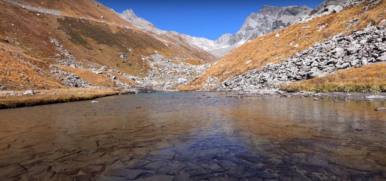
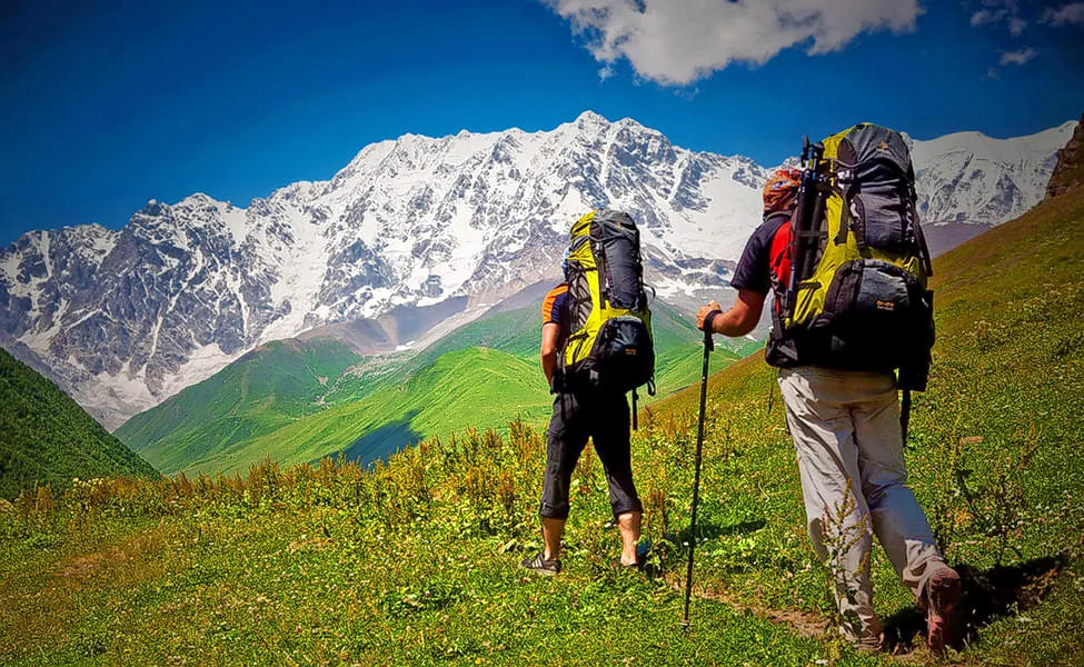
Discover a trail that covers meadows, villages, forests and other iconic features of the Himalayas with the Buran Ghati pass trek.
-
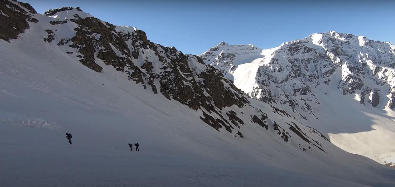
Climb to a height of 15,000 feet as you see one of the most thrilling Himalayan passes, the Buran Ghati Pass.
-
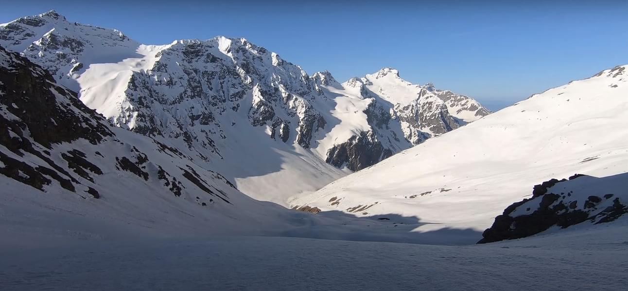
Experience the soothing calm around the Chandernahan Lake, which stays frozen throughout the year.
-
Witness one of the world's highest rappelling points and slide down thrilling snow chutes at Buran Ghati.
-
Spot unique Himalayan flora and fauna as you navigate the pine and oak forests of the trail.
Buran Ghati Trek Overview
About Buran Ghati Trek:
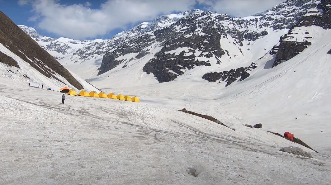
Embark on a beautiful trek that covers every aspect of the Himalayas as you choose to do the Buran Ghati trek with Thrillophilia. This trail offers one of the most perfect treks as it includes forests, meadows, villages, exciting climbs and much more. Buran Ghati trek itinerary covers around 40 kilometres filled with thrills and views like no other in the Himalayas.
The base of the trek is at Janglik, an ancient village that is untouched by civilisation and modernity. Once you start from here, every day will show a different kind of landscape. You will encounter the lush meadows of Dayara, the dense forests of Litham, and thrilling pass-crossing and snow fields.
The trail to Buran Ghati is a moderate-to-difficult journey suited for trekkers with basic experience. However, if you are a beginner with the required fitness levels, you can also join the trek. The journey starts from 9,415 feet and reaches 15,000 feet, making Buran Ghati one of the highest Himalayan treks.
Book your Buran Ghati trek package online with Thrillophilia and plan an itinerary that matches all your tastes. Our packages cater to all your needs and include meals, accommodation, trek guides, transfers, and activities. Enjoy a stress-free vacation in the Himalayas as we take care of all your plans.
Quick Facts about Buran Ghati Trek:
Duration: 7D/6N
Altitude: 15000 ft.
Buran Ghati Trek Difficulty: Moderate to Difficult
Buran Ghati Trek Distance: 37 km
Buran Ghati Temperature: 17° C to -5° C
Best time for Buran Ghati trek: Mid-May to early July & mid-September to mid-October
Railway Station: Chandigarh
Airport: Chandigarh
ATM: Shimla
Starting Point: Janglik
Ending Point: Brua Village
How to reach Janglik:
By Air: The nearest airport from Janglik with connectivity to major Indian cities is Chandigarh. The distance between the two locations is around 250 kilometres. You can reach Janglik from the Chandigarh airport in around eight hours by cab.
By Train: Kalka railway station is the closest railhead from Janglik, the base camp of the Buran Ghati trek. Kalka is well-connected to many Indian cities and is around 220 kilometres away from Janglik. You can cover the distance in around seven hours.
By Road: It takes about 04:00 hours to reach Shimla from Chandigarh. The buses from Chandigarh to Shimla run by RSRTC and are frequently available on daily basis.
Shimla to Janglik drive is an 8-9 hour drive from Shimla, and Janglik is the base camp for your trek. Shared Cabs are available.
Buran Ghati Trek Inclusions:
- Accommodation- Tent stays on sharing basis.
- Meals- Breakfast, packed Lunch, Dinner all vegetarian, and Snacks, Soup, Tea, and essential food material for trekking.
- Trekking Equipment- Sleeping bags, Sleeping mattresses, Sleeping tents, utensils.
- Permits- All fees and permits for Indians.
- Safety equipment- Basic First Aid Medical kit, Oxygen Cylinder, and Oxi Meter
- Expert TrekLeaders- Qualified and experienced Trek Leader and support staff.
Available Group Departure Dates:
September: 17, 25
October: 1, 8
Buran Ghati Trek Itinerary
Select Package Options
Buran Ghati Trek From Janglik - Brua Village
Buran Ghati Trek From Shimla
More Details about Buran Ghati Trek
Know Before You Go for Buran Ghati Trek
- Guidelines issued by the State-Government is to be followed.
- Please provide a valid ID at the time of check-in.
- The exact location will be shared with you post-booking.
- To ensure utmost hygiene, the place is daily cleaned and sanitized.
- Do not bring non-biodegradable materials
- Consumption of alcohol or any other intoxicating products is strictly prohibited.
- Porters or helpers to carry Central Equipment's.
- One can hire porter and mule for offloading, to carry personal luggage. (Weight not more than 10 kg.)
- Transportation from shimla to janglik can be availed at extra cost.
- It is recommended to carry enough warm clothes and the right kind of shoes for the trek.
Things To Carry for Buran Ghati Trek
- Warm clothes
- Rain cover
- Walking stick
- Head torch
- Hiking shoes
- Led torch (with extra batteries)
- Fleece jackets and thermals
- Back pack (50-60l)
- Toilet paper & wipes
